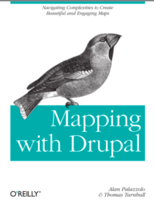
 Mapping with Drupal by Alan Palazzolo and Thomas Turnbull provides a hands-on, in-depth exploration of the most popular tools for turning your favourite CMS into a geospatially enabled data management system. Contextualising and demonstrating modules such as Geofield, GMap and Location modules and the OpenLayers framework, Palazzolo and Turnbull provide a superbly crafted guidebook to allow a user to quickly get up to speed and understand the strengths and weaknesses of available solutions.
Background information on cartography and a limited amount on extending Drupal quickly bring a novice up to speed. Subsequent chapters take a practical approach and the step-by-step instructions lead the reader through concrete real-world examples.
The volumes are well illustrated and comprehensive. It further offers useful references at handy points for those who would like to explore more deeply. This allows the authors to maintain a solid focus on moving through the work steps and o accomplish the projects. They demonstrate a particularly well thought out process and addresses many common reader thoughts just as they arise.
I was particularly impressed with the attention of the authors to look at the importance of how data is represented visually and the implications of making stylistic decisions about particular aspects of online cartography. Chapter 6 – Making Beautiful Maps is very thoughtful and recommended read even if you aren’t attempting to use the tools dealt with throughout the book as a whole. There are really about three separate aspects to this book. A hands-on tutorial, an overview of the context of online cartography and a superb bibliography that provides much fruit for future reference.
As the authors state, extensive knowledge of Drupal is not required, nor of online cartography or GIS. Although they work through examples relying on PHP, knowledge of such is not requisite and can be inferred from the content. This volume provides a self-paced and well-referenced approach to the subject of deploying geospatial visualizations within a content management system. It is highly recommended for novice to expert applying to anyone with the need to work with geospatial data.

